

Handover data that arrives structured, not stapled.
QA evidence attributed onto 2D objects today, and onto 3D objects next – built for inclusion in a federated as-constructed model. The records contractors already produce become structured information for the asset systems downstream – without additional effort on either side.

Design models and QA records never actually meet
BIM mandates produce a design model. The evidence that the thing was built to spec lives somewhere else entirely, joined back by macros and goodwill.
The model describes intent
A design model says what was meant to be built. It carries no record of what was inspected, tested, approved or rectified on the way.
The QA lands as documents
Conformance packs arrive as PDF bundles. Structured on the page, unstructured as data. Nothing downstream can consume them without a person in the middle.
Joining them is a project
Attributing QA evidence back onto model objects after the fact means reconciling two systems that were never built to talk. It gets budgeted, deferred, then dropped.
QA models from QA data
Instead of referencing everything back to a design model, CivilPro is building toward treating the 3D model as an index of QA records within a federated model – creating QA models directly from QA data, without depending on the design model's attributes.
The Lot is already the unit the work is delivered and signed off in. If the Lot knows where it is, the QA hanging off it knows where it is too.
- Lots defined against survey coordinate systems (MGA zones, WGS)
- Engineers define Lots in CivilPro – no third-party CAD required
- Surfaces linked to Lots generate 3D geometry (in development)
- Output via DXF or API into your environment
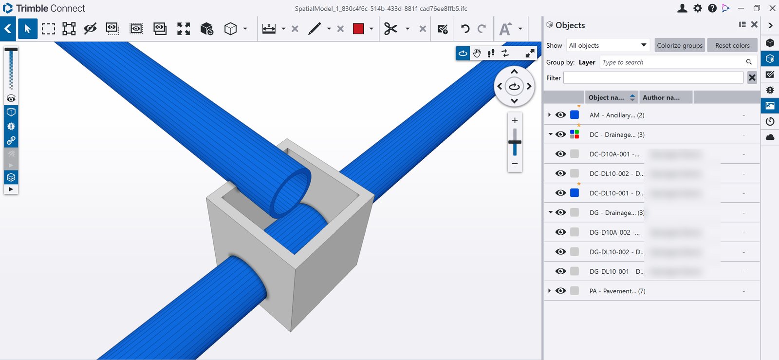
In development – an early CivilPro spatial model viewed in Trimble Connect. See where it's up to.
It builds on something already running
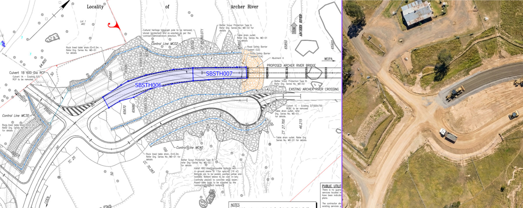
None of this starts from a blank sheet. Drawings are spatially registered when they are imported, so marking a Lot on them gives it a local coordinate definition. Every QA record attached to that Lot inherits it.
That is in production today, on major projects, being used by engineers who are not CAD operators. The 3D work extends it rather than replacing it.
- Chainage and offsets held on the record, not in a filename
- Lots and their linked QA searchable by location, not just a Lot number
- PDF construction drawings imported and georeferenced
- DXF and API export into whatever runs next to it
"Without additional effort on either side" — what that actually means
Contractors keep producing the QA records they're contractually obligated to produce – checklists, test results, conformance reports, all captured against Lots as the work happens. Because those records are already structured and spatially referenced in CivilPro, the as-constructed data set falls out of the delivery process rather than being assembled after it.
What we'd want from your team: the target data shape and specification, so the export lands cleanly in your systems. That's the conversation we'd like to have.
Into your mandated systems
Oracle Aconex and Teambinder integrations put Lot Summaries into the DMS your contracts already mandate, as linked Documents.
Into your asset systems
The API exposes everything the web UI can see. Maximo, AssetWise or in-house – the payload is shaped to your specification, not ours.
Into your model environment
DXF today. Object-level attribution as the 3D work lands, so QA evidence can be read against geometry rather than filed beside it.
Where this capability is up to
We would rather be straight about this than have you find out in a demo.
Shipped
2D Lot definition against survey coordinates. PDF drawing import with georeferencing. Lots and linked QA searchable by location. DXF and API export.
In development
Surface-linked 3D model generation from Lot data. IFC attribution of QA evidence onto objects.
In conversation
Federated as-constructed model workflows with asset owners – shaped with your team, not guessed at.
Half an hour with our founder
We would rather refine our approach in conversation with your team than guess. Tell us the shape your data needs to take.
Request a Technical Briefing